Webcams in Door County, Wisconsin, let you preview ferry docks, waterfronts and a famous rooftop before you go. These six camera views cover Northport, Fish Creek, Sister Bay and Sturgeon Bay. Use them alongside the weather forecast, road reports and your destination’s operating schedule.
Two views come from the same Northport ferry terminal, and two overlook Sturgeon Bay from one museum tower. This is a selection of official-source cameras, rather than a camera network covering every town, beach or island in the county.
Sources and player links reviewed Oct. 29, 2026. Continuous live playback was not confirmed for every feed. Outside streams can pause, change addresses or show recorded material; check the player’s live indicator and timestamp. The featured and conceptual section images are AI-generated illustrations.
Webcams in Door County: Choose Your View
| Camera | Location | Planning use |
|---|---|---|
| Northport Pier Ferry Dock — Camera 1 | Northport, mainland | Ferry-terminal preview |
| Northport Pier Ferry Dock — Camera 2 | Northport, mainland | Ferry-terminal preview |
| Fish Creek Town Dock | Fish Creek | Town-dock setting |
| Al Johnson’s Goat Cam | Sister Bay | Seasonal rooftop viewing |
| Maritime Museum Tower — North View | Sturgeon Bay | Working-waterfront perspective |
| Maritime Museum Tower — South View | Sturgeon Bay | Working-waterfront perspective |
Pick the view closest to the stop you are considering. Door County live cameras show only what is inside their frames; a sheltered dock does not establish conditions on the opposite shore or out on the lake.
Current Door County Weather and Water Conditions
The Windy map is centered near Fish Creek, with a regional view of the peninsula and surrounding water. It displays forecast wind in mph and temperatures in Fahrenheit. Check the timeline: the selected forecast hour may differ from the time shown by a webcam.
Open the National Weather Service forecast for Fish Creek, then choose a forecast point closer to your destination if needed. The NWS Green Bay office provides current hazards and marine information for the area.
For swimming or boating, check official warnings and posted local conditions. Lake Michigan webcams cannot measure currents, establish water quality or confirm that an exposed crossing is suitable for your trip.
1. Northport Pier Ferry Dock — Camera 1
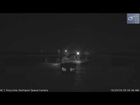
Washington Island Ferry Line labels this mainland feed Northport Pier Camera 1. It offers a terminal-area preview before an island trip. Use the operator’s current schedule and trip information to confirm sailings rather than estimating a departure from a camera picture.


Open Northport Pier Ferry Dock — Camera 1 on the official source page
The saved thumbnail is a low-light terminal view. Check the live player for a more recent image and watch for a timestamp that has stopped advancing.
2. Northport Pier Ferry Dock — Camera 2
Northport Pier Camera 2 provides another view at the same mainland terminal. It is a second angle, not another community or a separate ferry route. Compare the two Northport feeds when one view is unclear.


Open Northport Pier Ferry Dock — Camera 2 on the official source page
Its thumbnail was obstructed during review, so the supporting image here is an illustration. A camera cannot guarantee space on a sailing; consult the ferry operator for travel arrangements.
3. Fish Creek Town Dock
The Town of Gibraltar links to this town-dock camera from its official website. Fish Creek’s dock view is useful for a look at the harbor area before a waterfront walk or a visit nearby.

Open Fish Creek Town Dock on the official source page
The camera thumbnail was dark during review. We used an illustration rather than presenting that dark image as a useful daytime preview. Follow the town’s source link if the player is unavailable.
4. Al Johnson’s Goat Cam
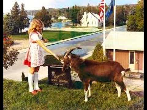
Al Johnson’s rooftop camera is a Sister Bay webcam with a seasonal purpose: watching the restaurant’s goats. The operator says they are usually on the sod roof from late May through mid-October and are brought down each evening.

Open Al Johnson’s Goat Cam on the official source page
Do not plan a late-fall or winter stop on the assumption that goats will be outside. The supporting thumbnail is promotional imagery supplied with the video, not a current roof view. Check the restaurant’s own information before making a special trip.
5. Maritime Museum Tower — North View
The Door County Maritime Museum shares a north-facing tower feed from the Baumgartner Observation Deck atop the Jim Kress Maritime Lighthouse Tower. The museum credits these tower cameras to the City of Sturgeon Bay.

Open Maritime Museum Tower — North View on the official source page
This is one perspective on the working waterfront. Boats shown in an older thumbnail may have moved; use the player and its timestamp for the latest available scene.
6. Maritime Museum Tower — South View
The south-facing tower camera provides a second angle from the same museum location. Pair these Sturgeon Bay webcams for a broader waterfront preview without treating them as views from two different attractions.
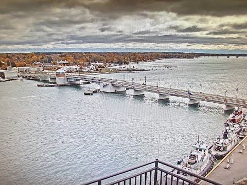

Open Maritime Museum Tower — South View on the official source page
The source page also lists other regional feeds. Museum admission and visitor access are separate from watching a camera; check the museum directly for hours and tickets.
Wisconsin Traffic Dashboard: Check Your Route
Open 511 Wisconsin before departure. Move the map to your route through Door County and enable the Cameras, Incidents, Closures or Roadwork layers as needed. Select an available road camera for the part of the drive you want to check.
Camera coverage is limited to mapped locations. A clear view at one intersection does not describe every road ahead, and a harbor camera is not a traffic report. Check updates while parked or let a passenger handle them.
Door County Weather Radar
Use the National Weather Service radar map to follow precipitation near northeastern Wisconsin. Move to the Door Peninsula and play the radar loop rather than relying on a single frame.
Compare radar with your destination and planned travel time. Webcams in Door County provide a ground-level perspective, while radar and forecasts answer different questions about approaching weather. Neither replaces an official warning.
Current Door County News

Recent Google News results matching “Door County Wisconsin.” Select a headline to read the report at its source. Search results may include broader regional coverage or older stories.
See Before You Go: Plan a Door County Visit
Start with Sturgeon Bay if you want a working-waterfront perspective. Use Fish Creek’s town-dock source for a different harbor setting. For Sister Bay, check the goat season before building your plans around that camera.
If Washington Island is your destination, use the Northport camera pages alongside the ferry operator’s current trip information. Allow time for your own travel arrangements; these camera views are not a reservation system or a ferry timetable.
Destination Door County’s visitor-center directory provides local contacts for more detailed planning. Our Sheboygan County webcam guide offers another Wisconsin waterfront option.
Questions About Webcams in Door County
Are all six feeds confirmed to be playing live?
No. We checked official source pages and player links, but we couldn’t confirm continuous playback; we couldn’t check the player’s live status and timestamp.
Can I see the goats year-round?
No. Al Johnson’s describes a usual late-May-to-mid-October rooftop season, with goats brought down each evening. Weather and operating decisions can affect what you can see.
Do these cameras cover Washington Island?
The two embedded ferry views are labeled Northport Pier cameras on the mainland. The operator lists another feed as a Washington Island dock camera, but its thumbnail label was inconsistent during review, so we didn’t count it in this guide.
Why are some images dark or different from the player?
The supporting images are static thumbnails or labeled illustrations. They do not update with the video. Nighttime, lens obstructions, maintenance, and changed stream addresses can also limit the view.
What time zone should I use?
Door County follows Central Time. Compare that with any timestamp or forecast timeline before deciding how recent a scene is.
Can a webcam confirm that a ferry is running or a beach is safe?
No. Confirm sailings with the ferry operator, and check official hazards and posted beach notices for water-related plans. A visible boat or calm-looking frame is insufficient.
Bookmark these Door County webcams for a quick preview before your next outing. Pair the camera closest to your stop with the forecast, road reports and operator information to make the picture useful.